Satellite tracking of birds: how scientists study migration in real time
Bird migration has always carried a sense of mystery. Long before modern science, people noticed that swallows vanished before winter, cranes crossed the sky in clean formations, and geese seemed to know routes that no human had taught them. For centuries, much of that movement was visible only in fragments: a flock passing overhead, a bird ring recovered far from where it was first marked, a sudden arrival on a wetland after weeks of silence. Scientists could guess at the larger journey, but many details remained hidden between one sighting and the next.
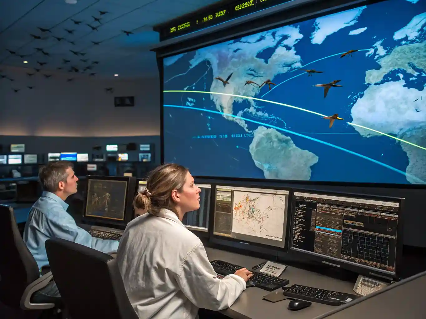
Satellite tracking has changed that view dramatically. Tiny transmitters now allow researchers to follow individual birds across continents, oceans, deserts, mountain ranges, and political borders. Instead of studying migration only through isolated records, scientists can watch a moving path unfold almost in real time. A bird that leaves northern Europe, crosses the Mediterranean, rests in North Africa, and continues toward the Sahel can now leave a digital trail that reveals timing, speed, stopover sites, altitude patterns, and survival risks along the way.
This does not make migration less fascinating. It makes it more alive. Every dot on a map represents a living animal making decisions under pressure: where to feed, when to wait, how to avoid storms, how much energy to spend, and whether to change course when landscapes below are altered by people. Satellite tracking gives researchers a sharper way to ask why birds move as they do, and it also gives conservationists practical evidence for protecting the places birds depend on during their long journeys.
How satellite tracking works
Satellite tracking begins with a small device attached to a bird in a way that allows the animal to behave as naturally as possible. The transmitter is usually fitted like a light backpack using a harness, though some species may carry devices in other ways depending on their body shape, feathers, and behaviour. The main rule is simple: the tag must be light enough not to affect flight, feeding, breeding, or survival. Researchers generally keep the device below a small percentage of the bird’s body weight, and every project must pass ethical review before fieldwork begins.
Once fitted, the transmitter records location data. Older systems often relied on the Argos satellite network, which estimates positions from signals sent by the tag. Many modern trackers use GPS, which can provide highly accurate locations. Some devices store data until the bird is recaptured, while others send information remotely through satellites or mobile networks. For large birds such as eagles, storks, cranes, albatrosses, and geese, researchers can often use solar-powered tags that work for months or even years. Smaller songbirds require lighter solutions, so the amount of data collected may be more limited.
The information does not appear as a perfect movie of the bird’s life. It arrives as a chain of locations, sometimes frequent, sometimes sparse. A tracker may send several points per day, one point every few days, or bursts of data when conditions allow. Battery power, sunlight, cloud cover, body position, terrain, and transmission schedules all influence what scientists receive. Even so, a series of reliable positions can reveal an astonishing amount. Researchers can calculate speed, direction, distance, stopover duration, migration corridors, and repeated use of certain sites over multiple seasons.
Real-time tracking is especially valuable because it reduces the delay between movement and interpretation. If a tagged bird suddenly stops moving, scientists can investigate whether it has died, lost its tag, entered an area with poor signal, or settled at a breeding or wintering site. If several birds change direction ahead of a storm system, researchers can compare movement data with weather records. If migrants repeatedly gather in a wetland, that place may become a conservation priority even if it was previously overlooked.
The technology works best when combined with field knowledge. A satellite point on its own is just a coordinate. Its meaning comes from understanding the species, the season, the habitat, and the pressures along the route. A long pause may be a feeding stop, a breeding attempt, an injury, or a normal part of the bird’s annual cycle. Scientists interpret the data carefully, often checking maps, climate information, land use, and observations from local experts before drawing conclusions.
Why migration is difficult to study
Migration is not a single journey from one fixed place to another. It is a complex annual rhythm shaped by food, weather, daylight, breeding needs, competition, predators, and inherited navigation abilities. Many birds travel thousands of kilometres, but they do not all move in the same way. Some follow coastlines, some cross open sea, some move at night, some ride rising warm air over land, and some make huge non-stop flights that push the limits of endurance.
Traditional methods taught scientists a great deal, but they also had limits. Bird ringing, or banding, involves placing a small marked ring on a bird’s leg. If the bird is later found or recaptured, researchers learn where it went. This method has built a huge foundation of migration knowledge, yet it depends on chance recovery. A bird may travel across several countries and leave no record unless someone sees, catches, or finds it. Visual surveys and radar have also been useful, but they often show broad movement rather than the complete life of one individual.
Satellite tracking fills many of these gaps because it follows the same bird through the invisible parts of the journey. It can show whether a bird flies directly across a sea or follows land around it. It can reveal that two birds from the same colony take completely different routes. It can show how young birds explore more widely than adults, or how experienced adults return to the same stopover sites year after year. These details matter because migration is full of individual choices, not just species-wide patterns.
Birds also travel through rapidly changing landscapes. Wetlands are drained, grasslands are converted to agriculture, forests are cut, rivers are dammed, cities expand, and artificial lights spread across night skies. A route that worked for thousands of years can become more dangerous within a few decades. Satellite tracking helps scientists see where these changes intersect with migration paths. It can reveal whether birds are avoiding new wind farms, crossing expanding urban areas, or losing access to feeding grounds that once supported them during long flights.
There is also the challenge of scale. A bird may breed in the Arctic, refuel in Europe, cross the Sahara, and winter in tropical Africa. Protecting that species requires knowledge across many regions. A single country may protect nesting sites well, but the population can still decline if vital stopover wetlands disappear elsewhere. Satellite tracking makes these links visible. It shows that conservation cannot stop at national borders because the bird’s life does not stop there.
Migration is difficult to study because it combines biology, geography, climate, and behaviour in motion. The same route may be safe one year and dangerous the next. A strong tailwind can help a bird cross a barrier; a heatwave can dry up a feeding site; a storm can push migrants far off course. Satellite data gives scientists the chance to connect these events to actual decisions made by birds in flight.
What real-time data reveals
The greatest strength of satellite tracking is not only knowing where a bird goes, but knowing when and how it moves. Timing is crucial in migration. A bird that leaves too early may face poor feeding conditions. A bird that leaves too late may miss the best breeding window. Real-time data helps researchers understand how birds adjust their schedules and whether they can keep pace with environmental change.
For many species, migration is built around stopover sites. These are places where birds rest, feed, and rebuild energy reserves. To a casual observer, a wetland or mudflat may look like a temporary gathering place. To a migrating bird, it can be the difference between survival and exhaustion. Satellite tracking can show how long birds remain at these sites, how often they return, and what happens when those places are disturbed. A short stop may indicate quick refuelling in rich habitat. A long stop may suggest abundant food, poor weather ahead, or difficulty gaining enough energy to continue.
Tracking also reveals the importance of wind. Large soaring birds such as storks, vultures, and eagles often depend on rising columns of warm air called thermals. These help them gain height without constant flapping. Because thermals form mostly over land, many soaring birds avoid long sea crossings and concentrate at narrow migration points such as straits. Satellite data makes these routes clear and shows why certain geographic bottlenecks attract enormous numbers of migrants.
Seabirds offer a different picture. Albatrosses, shearwaters, petrels, and other ocean travellers may cover vast distances over open water. Their tracks can show how closely they follow winds, currents, fishing zones, and productive ocean fronts where food is abundant. In some cases, tracking has revealed that seabirds overlap heavily with fishing fleets, increasing the risk of bycatch. This evidence has helped guide safer fishing practices in areas where vulnerable birds are most at risk.
Real-time data also shows how migration differs between adults and young birds. Adults often have established routes and reliable stopover sites. Young birds may wander, test different paths, or spend their first years exploring. These early movements can be risky, but they may also help birds learn landscapes and develop future migration strategies. Without tracking, much of this early life would remain unknown because young birds are rarely observed across their full range.
A simplified comparison helps show what different tracking tools can contribute to migration research.
| Tracking method | Best suited for | Main strength | Main limitation |
|---|---|---|---|
| Satellite transmitter | Medium and large birds crossing remote regions | Sends data from places where people cannot observe the bird | Usually too heavy for the smallest species |
| GPS tag with remote download | Birds that can carry precise location devices | Gives highly accurate movement paths | Battery life and data transmission can be limiting |
| Light-level geolocator | Small migratory birds | Very light and useful for broad route patterns | Often requires recapturing the bird to recover data |
| GPS logger | Species likely to return to the same site | Detailed stored movement data | Data may be lost if the bird is not found again |
| Radar monitoring | Large-scale migration over a region | Shows broad movement intensity and direction | Usually cannot identify individual birds |
The value of these methods increases when they are used together. A satellite transmitter can follow one bird across remote landscapes, while radar can show how many birds are moving through a region on the same night. Field observations can confirm habitat use, and weather data can explain sudden changes in route. The strongest research often comes from combining several sources rather than relying on one device alone.
Real-time tracking also has emotional power. When conservation groups share migration maps with the public, people can follow named birds as they cross continents. This makes migration easier to understand and care about. A distant ecological process becomes a visible journey with danger, effort, and return. That public interest can support conservation projects, especially when people see that a bird breeding near them may depend on wetlands thousands of kilometres away.
How tracking helps conservation
Satellite tracking has become one of the most practical tools in bird conservation because it turns movement into evidence. Conservation often depends on knowing where action will have the greatest effect. If a threatened species uses one breeding site, three stopover wetlands, and a wintering area under pressure from development, protecting only the breeding site may not be enough. Tracking shows the full chain of places that support survival.
One of the clearest uses is identifying migration corridors. These are routes that many birds follow because geography, wind, and habitat make them efficient. When a corridor passes through dangerous areas, conservationists can focus work there. For soaring birds, narrow land bridges and straits may be critical. For shorebirds, chains of coastal wetlands may be essential. For raptors, safe passage through mountain valleys may matter more than wide areas of unsuitable land.
Tracking can also reveal hidden mortality. If several tagged birds disappear in the same region, scientists can investigate possible causes. The issue may be illegal killing, poisoning, collision with power lines, habitat loss, or interaction with fishing gear. Without tracking, these losses might be scattered and invisible. With movement data, patterns become easier to detect.
The technology is especially important for species that live in remote or difficult places. Arctic-breeding birds, oceanic seabirds, desert migrants, and wide-ranging raptors may spend much of their lives beyond regular human observation. Satellite tracking gives researchers access without needing to follow them physically. This reduces guesswork and helps direct limited conservation funds toward the places that matter most.
Tracking can support several kinds of conservation decisions:
• Protecting wetlands, grasslands, forests, islands, and coastal zones that repeatedly appear in migration tracks.
• Adjusting the placement or operation of wind turbines, power lines, and other infrastructure near important flight paths.
• Reducing seabird bycatch by identifying overlap between bird movements and fishing activity.
• Strengthening international agreements when one population depends on several countries during the year.
• Monitoring whether restored habitats are actually used by migrating birds.
These actions show why migration research is not only academic. A line on a map can lead to a protected reserve, a changed fishing rule, a safer power line design, or a cross-border conservation plan. The data becomes a bridge between scientific observation and practical protection.
Climate change has made this work more urgent. Many birds time their migration to match seasonal food peaks, such as insect emergence or plant growth. If warming changes those peaks, birds may arrive too early or too late. Satellite tracking helps scientists see whether species are adjusting their timing, shifting routes, or suffering lower survival. It can also show whether traditional stopover sites are becoming less reliable because of drought, sea-level rise, or altered land use.
There is another important benefit: tracking can challenge assumptions. A species may be thought to winter in one broad region, but tagged birds may reveal that the most important sites are much more specific. A protected area may look suitable, yet tracks may show birds consistently avoiding it. A planned development may seem harmless until data reveals that it sits on a heavily used flight path. Good conservation depends on this kind of correction. It is better to know exactly where birds go than to protect places based on habit or guesswork.
Limits and ethical questions
Satellite tracking is powerful, but it is not magic. Every device adds weight, and every capture creates stress. Responsible researchers treat these concerns seriously. The welfare of the bird must come before the desire for data. A poorly fitted tag can affect movement, damage feathers, or reduce survival. That is why field teams need training, careful permits, and species-specific methods.
The size of the bird matters greatly. Large species can carry more advanced devices, while small birds cannot. A stork or eagle may carry a solar-powered GPS transmitter that sends detailed data for years. A tiny warbler may only be able to carry a light geolocator that provides broad location estimates and must be recovered later. This creates an imbalance in knowledge. Scientists often know far more about the movements of large birds than about the full journeys of the smallest migrants.
Data quality is another limitation. A missing signal does not always mean a bird has died. The tag may have failed, the battery may be low, the bird may be under dense cover, or the transmitter may not have a clear path to send data. Researchers must avoid rushing to dramatic conclusions from incomplete information. Careful analysis includes uncertainty, error ranges, and comparison with other evidence.
Cost can also restrict research. High-quality satellite tags, field expeditions, permits, data plans, and long-term analysis require funding. Many regions with globally important bird migration routes have limited research budgets. This can leave major gaps in knowledge, especially in parts of the world where conservation pressure is high but scientific resources are stretched.
There are also questions about sharing sensitive data. Public migration maps can inspire people, but exact locations may endanger rare birds if they reveal nesting sites or predictable resting areas. For species threatened by illegal collecting, persecution, or disturbance, researchers may delay data release or show only generalized tracks. Openness is valuable, but it must not put birds at greater risk.
Ethical tracking means asking whether the knowledge gained justifies the intervention. In many cases, the answer is yes because the data can protect entire populations. But each project must be designed with care. The best studies use the lightest suitable devices, minimize handling time, monitor possible effects, and share findings in ways that help conservation rather than simply producing attractive maps.
The future of migration science
The next stage of bird tracking is likely to be smaller, smarter, and more connected. Devices are already improving quickly. Batteries are becoming more efficient, solar panels are lighter, and tags can collect more than location. Some can record acceleration, temperature, altitude, or behaviour patterns. This helps researchers understand not just where a bird is, but whether it is flying, resting, feeding, diving, or struggling.
As tags shrink, more species can be studied. This is especially important for small songbirds, many of which migrate at night and have declined sharply in several regions. Their journeys are harder to observe, yet they play major roles in ecosystems as insect predators, seed dispersers, and indicators of environmental health. Better tracking tools may reveal unknown routes, overlooked stopover sites, and threats that have been difficult to measure.
Artificial intelligence and advanced modelling are also changing how migration data is used. Large datasets can be compared with weather, land cover, ocean conditions, moonlight, human activity, and long-term climate trends. Patterns that once took years to detect can emerge more quickly. Researchers can predict when birds are likely to move through certain areas, which can help reduce risks from lights, turbines, or other hazards during peak migration nights.
Real-time systems may also become more useful for rapid conservation response. If endangered birds approach a dangerous zone, managers could temporarily adjust human activity. If large numbers of migrants are expected to pass over a city, building lights could be dimmed during critical nights. If birds rely on a wetland during drought, water management could be adjusted to support feeding habitat. These ideas require coordination, but the science is moving in that direction.
Citizen science will remain important as well. Satellite data is strongest when paired with observations from people on the ground. Birdwatchers, local communities, reserve staff, fishers, farmers, and volunteers can help confirm what tracked birds are doing in real places. A coordinate may show where a bird stopped; local knowledge can explain whether the site is flooded, farmed, disturbed, restored, or rich in food.
The future of migration science will not be only about better devices. It will be about better cooperation. Birds connect countries whether people plan for it or not. A single individual may depend on safe breeding habitat in one region, safe passage through another, and winter food in a third. Tracking makes those connections visible. The challenge is turning visibility into protection.
Conclusion
Satellite tracking has transformed the study of bird migration from a science of scattered clues into a science of moving lives. It allows researchers to follow individual birds through the hardest parts of their journeys and to understand how routes, timing, weather, landscapes, and risks shape survival. The result is a much richer picture of migration than older methods could provide alone.
The technology also changes how people think about birds. A migrant is no longer just a seasonal visitor. It is a traveller linked to distant wetlands, coastlines, forests, deserts, farms, and oceans. Its survival may depend on decisions made in several countries across the same year. Real-time tracking shows that conservation must follow the bird’s whole journey, not just the place where people happen to see it.
The more scientists learn, the clearer the message becomes: migration is not random movement across empty space. It is a finely balanced system built on memory, instinct, weather, energy, and habitat. Satellite tracking helps reveal that system while there is still time to protect it. Every signal sent from the sky carries more than a location. It carries evidence of how life moves across the planet and what must be kept safe for those journeys to continue.